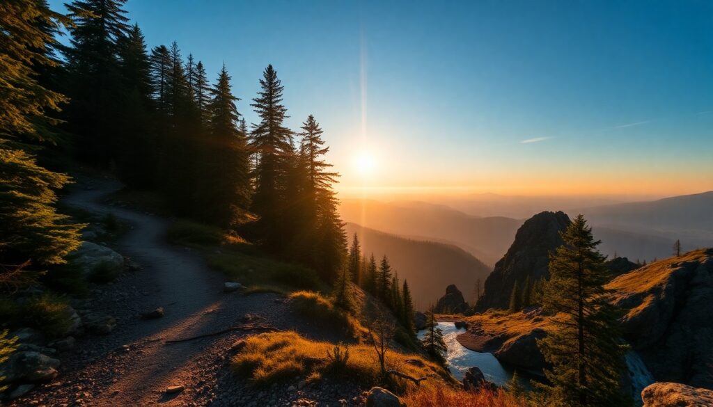
As you step onto the Mount Si Summit Trail, the dense, emerald canopy of old-growth forest immediately embraces you, filtering the sunlight into a dappled, otherworldly glow. The scent of damp earth and ancient fir needles fills the air, a natural perfume that invigorates your senses before the real climb begins. It’s an iconic ascent, promising not just a physical challenge but a profound connection to the raw beauty of the Pacific Northwest, culminating in breathtaking panoramas that stretch from the Puget Sound to the distant Olympic Mountains.
Trail Specifications
Trail Name: Mount Si Summit Trail
Location: North Bend, Washington
Distance: Approximately 8 miles (round trip)
Elevation Gain: Approximately 3,150 feet
Difficulty: Strenuous
GPS Coordinates (Trailhead): 47.4912° N, 121.7583° W
Best Season: Late Spring through Fall (May – October)
Dog-Friendly: Yes, on leash
Route Overview & Natural Highlights
The Mount Si Summit Trail is an unyielding ascent through a magnificent example of a Western Washington old-growth forest. From the outset, you’ll find yourself navigating a well-maintained but relentlessly uphill path, initially wide and relatively smooth before transitioning into a more rugged, root- and rock-strewn terrain. The trail carves its way through a verdant landscape dominated by towering Douglas Fir (Pseudotsuga menziesii) and Western Hemlock (Tsuga heterophylla) trees, some centuries old, their immense trunks draped in moss and lichens that thrive in the region’s moist climate.
As you gain elevation, the forest floor transforms into a lush understory of sword ferns (Polystichum munitum), salal (Gaultheria shallon), and various huckleberry bushes. Keep an eye out for local wildlife; you might spot Steller’s Jays flitting through the canopy, or hear the distinct call of a Pileated Woodpecker. Higher up, particularly near the exposed rocky sections, you may even catch a glimpse of a pika or a marmot. The geological formations along the route are primarily composed of basalt, a dark, fine-grained volcanic rock, a remnant of the Cascade Range’s fiery origins. These ancient rocks, sometimes slick with moisture, add to the trail’s challenging character but offer excellent grip when dry. The panoramic views from the summit, including the dramatic Snoqualmie Valley and the iconic Twin Falls area in the distance, are the ultimate reward for your efforts.
Turn-by-Turn Trail Breakdown
Trailhead Start: The Forest Ascent
Your journey begins on a wide, well-graded path that immediately starts climbing. The first mile is a series of gentle switchbacks through a dense, younger forest, offering a relatively smooth introduction to the elevation gain. You’ll cross a few small streams, often just trickles, but prepare for muddy sections after rainfall. This initial segment allows you to find your rhythm before the trail steepens considerably.
Mid-Trail Features: The Grind & The Haystack Approach
Beyond the first mile, the trail narrows and becomes more challenging, characterized by an increasing number of roots and rocks underfoot. You’ll pass the junction for the Little Si Trail, another popular hike in the area, though you will continue straight. The grade becomes relentless here, with few flat sections to offer respite. Listen for the rustling of leaves or the chirping of birds as you push through this demanding middle section. As you near the top, the forest thins slightly, and you’ll begin to see glimpses of the surrounding peaks, teasing the grand reveal to come. This section leads directly to the base of the “Haystack,” the prominent rock pinnacle that defines Mount Si’s summit.
Summit & Return: Panoramic Rewards
Upon reaching the main summit area, you’ll find expansive rocky outcrops offering spectacular 270-degree views. To reach the true summit, a short, exposed, and strenuous class 3 scramble up “The Haystack” is required. This optional ascent rewards experienced hikers with the highest point and even more dramatic vistas. From the main summit, you can identify landmarks like the Seattle skyline on a clear day, the Olympic Mountains to the west, and the vast expanse of the Cascade Range to the east, including nearby Mailbox Peak. Take time to absorb the views and refuel before beginning your descent. The return journey follows the same path, requiring careful footing on the steep, sometimes slippery, downhill sections.
Seasonal Guide & Best Times
- Spring (April – June): Snow may persist on upper sections until late May or early June. Expect muddy, wet conditions and potentially slick rocks. Wildflowers like trillium begin to bloom in the lower elevations. Weekdays are less crowded.
- Summer (July – September): The most popular season. Trails are typically dry, and weather is generally clear and warm, offering the best views. Start early to avoid crowds and afternoon heat.
- Autumn (October – November): Crisp air, fewer crowds, and pleasant hiking temperatures. Lower elevation foliage begins to show subtle color changes. Be prepared for cooler temperatures, rain, and potentially early snow in late November.
- Winter (December – March): Expect snow and ice on the upper half of the trail, often starting around 2,000 feet. Microspikes, gaiters, and potentially an ice axe are essential. Offers solitude but demands significant experience and preparation for winter conditions.
Essential Gear & Safety
- Sturdy Hiking Boots: With good ankle support and traction for roots and rocks.
- Water and Snacks: Bring at least 2-3 liters of water per person and plenty of high-energy snacks.
- Layered Clothing: Weather can change quickly; pack moisture-wicking layers, a rain jacket, and an insulating layer.
- Navigation: A map, compass, or GPS device (and knowledge of how to use them) in addition to your phone.
- First-Aid Kit: For minor scrapes, blisters, or emergencies.
- Headlamp/Flashlight: Even if you plan to be back before dark, it’s a good safety item.
- Trekking Poles: Highly recommended for stability and to reduce strain on knees, especially on the descent.
- Always inform someone of your hiking plans and expected return time. For more detailed trail information and recent conditions, visit AllTrails – Mount Si Summit Trail.
Getting There & Parking
The Mount Si Summit Trailhead is conveniently located just outside North Bend, Washington. From Seattle, take I-90 East to Exit 32 (436th Avenue SE). Turn left onto 436th Avenue SE, then turn right onto North Bend Way. Continue for a short distance, then turn left onto SE Mount Si Road. Follow SE Mount Si Road for approximately 2.5 miles until you reach the large parking lot on your left. Parking is plentiful but fills up quickly on weekends, especially during summer months, so arrive early. A valid Discover Pass is required to park at the trailhead. Day passes can often be purchased on-site via an automated machine, or you can purchase an annual pass online or at various retailers. The parking lot is typically open from dawn until dusk.
Curated Literature & Seattle Downtown Calendar
The Architecture of Focus: Deep Work & Modern Mastery
By Founders Library Press
A structured framework for strategic clarity, productivity, and authentic execution.
Upcoming Downtown Happenings
Live acoustic sessions, gallery receptions, literary salons, and independent trade shows across Seattle.