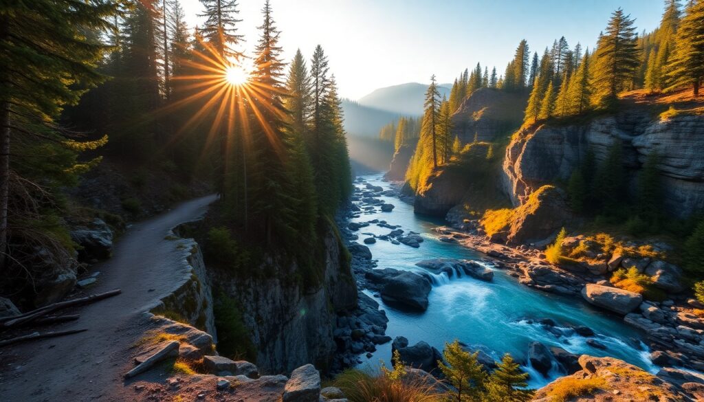
The crisp scent of damp earth and ancient conifers fills the air as you approach, a gentle roar growing louder with each step. Suddenly, the forest canopy opens to reveal the spectacular multi-tiered cascade of Franklin Falls, its icy waters plunging into the South Fork Snoqualmie River. This breathtaking natural amphitheater is the heart of the Franklin Falls River Walk, a beloved Puget Sound escape that promises a refreshing journey into the heart of the Cascades, even on the warmest days.
Trail Specifications
Trail Name: Franklin Falls River Walk
Location: Snoqualmie Pass, WA (near North Bend)
Distance: 2.0 miles (roundtrip)
Elevation Gain: 400 feet
Difficulty: Easy to Moderate
GPS Coordinates (Trailhead): 47.3828° N, 121.4137° W
Best Season: Year-round (with proper gear in winter)
Dog-Friendly: Yes, on leash
Route Overview & Natural Highlights
Your journey on the Franklin Falls River Walk begins with a gentle descent through a lush, old-growth forest, dominated by towering Douglas firs and Western Hemlocks. The air here is often cool and moist, fostering an abundance of vibrant mosses, ferns, and lichens that drape over fallen logs and basalt boulders, creating a verdant, almost primeval landscape. As you wind your way down, the soothing sounds of the South Fork Snoqualmie River become your constant companion, a clear indicator of the glacial meltwater that feeds this vital waterway.
The trail follows the river’s contours, offering glimpses of its rushing currents and serene pools. Keep an eye out for dippers, small, dark birds known for their unique habit of walking underwater along riverbeds in search of aquatic insects. In late summer and early autumn, you might even spot salmon making their arduous journey upstream to spawn. The geological story of the region is palpable; the trail itself is often cut into ancient volcanic basalt, evidence of the dramatic forces that shaped the Cascade Range millions of years ago, long before the creation of the nearby Iron Horse State Park Trail.
As you near the falls, the forest transforms into a natural grotto. The sheer rock faces, perpetually wet from the mist, host unique plant communities. The payoff is extraordinary: Franklin Falls, a magnificent 70-foot waterfall cascading over three distinct tiers into a wide basin. The spray creates a microclimate, sustaining delicate ferns and wildflowers that thrive in the constant moisture. It’s a truly immersive experience, inviting you to feel the cool mist on your face and absorb the raw power of nature.
Turn-by-Turn Trail Breakdown
Trailhead Start (0.0 – 0.5 miles)
From the main parking area, the trail begins as a wide, well-maintained path, gently descending into the forest. You’ll immediately be enveloped by the dense canopy, providing welcome shade. The initial segment is family-friendly, with minimal obstacles, winding along the river’s north bank. Listen for the distinct calls of Stellar’s Jays and the rustling of small mammals in the undergrowth.
Mid-Trail Features (0.5 – 0.9 miles)
The path narrows slightly and becomes a bit more rugged here, with occasional roots and rocks underfoot. You’ll cross a sturdy wooden bridge over a tributary, offering picturesque views of the forest floor. The sound of Franklin Falls grows steadily louder, building anticipation. You may notice sections where the trail runs alongside the historic grade of the Milwaukee Road, a nod to the area’s rich railway history that once connected the region to the broader Pacific Northwest, eventually becoming part of the Snoqualmie Pass infrastructure.
Summit/Destination & Return (0.9 – 2.0 miles)
The final descent to the falls can be steep and often wet, with some exposed roots and slippery rocks. Use caution, especially in damp conditions. You’ll arrive directly at the base of Franklin Falls, where a large, flat area allows for ample viewing and photography. Take your time to explore the different vantage points, feeling the refreshing spray. The return journey is simply retracing your steps, offering a gentle uphill climb back to the trailhead, allowing you to reflect on the beauty you’ve just witnessed.
Seasonal Guide & Best Times
- Spring (April – May): Snowmelt swells the falls, making them particularly powerful. Wildflowers like trillium and bleeding heart begin to bloom along the trail. Expect muddy sections.
- Summer (June – August): The most popular season. Water levels are lower, allowing for easier access to the falls’ basin. The trail is generally dry and warm, perfect for a leisurely stroll.
- Autumn (September – October): A quieter time to visit. Bigleaf maples and other deciduous trees add splashes of gold and crimson to the evergreen forest. The air is crisp, and the river begins to swell again with seasonal rains.
- Winter (November – March): A magical, albeit challenging, experience. The falls often freeze into stunning ice formations. The trail can be very icy and snowy; microspikes or crampons are essential. Check conditions before you go.
Essential Gear & Safety
- Sturdy Footwear: Waterproof hiking boots with good traction are recommended year-round, especially for the often-wet final approach to the falls.
- Layers: The Pacific Northwest weather can change quickly. Bring rain gear and warm layers, even on sunny days.
- Water & Snacks: Stay hydrated, especially during the uphill return.
- Traction Devices (Winter): Microspikes or crampons are absolutely necessary for icy winter conditions.
- Leave No Trace: Pack out everything you pack in. Respect wildlife and stay on marked trails.
- Trail Details: For more detailed information, consult the Franklin Falls Trail on AllTrails.
Getting There & Parking
From Seattle, head east on I-90. Take Exit 47 for Denny Creek/Tinkham Road. Turn right onto Forest Road 58. Follow FR-58 for about 2 miles until you reach the signed trailhead parking lot on your left. The lot can fill up quickly, especially on weekends, so consider an early start. A Northwest Forest Pass or America the Beautiful Pass is required to park at the trailhead. You can purchase a day pass on-site via a self-service envelope, but it’s often more convenient to buy one in advance. The road to the trailhead is typically open from late spring through late fall; in winter, the road is gated at I-90 Exit 47, adding significant distance to your hike if you choose to go.
Curated Literature & Seattle Downtown Calendar
The Architecture of Focus: Deep Work & Modern Mastery
By Founders Library Press
A structured framework for strategic clarity, productivity, and authentic execution.
Upcoming Downtown Happenings
Live acoustic sessions, gallery receptions, literary salons, and independent trade shows across Seattle.